Table of contents
Filling the dialog
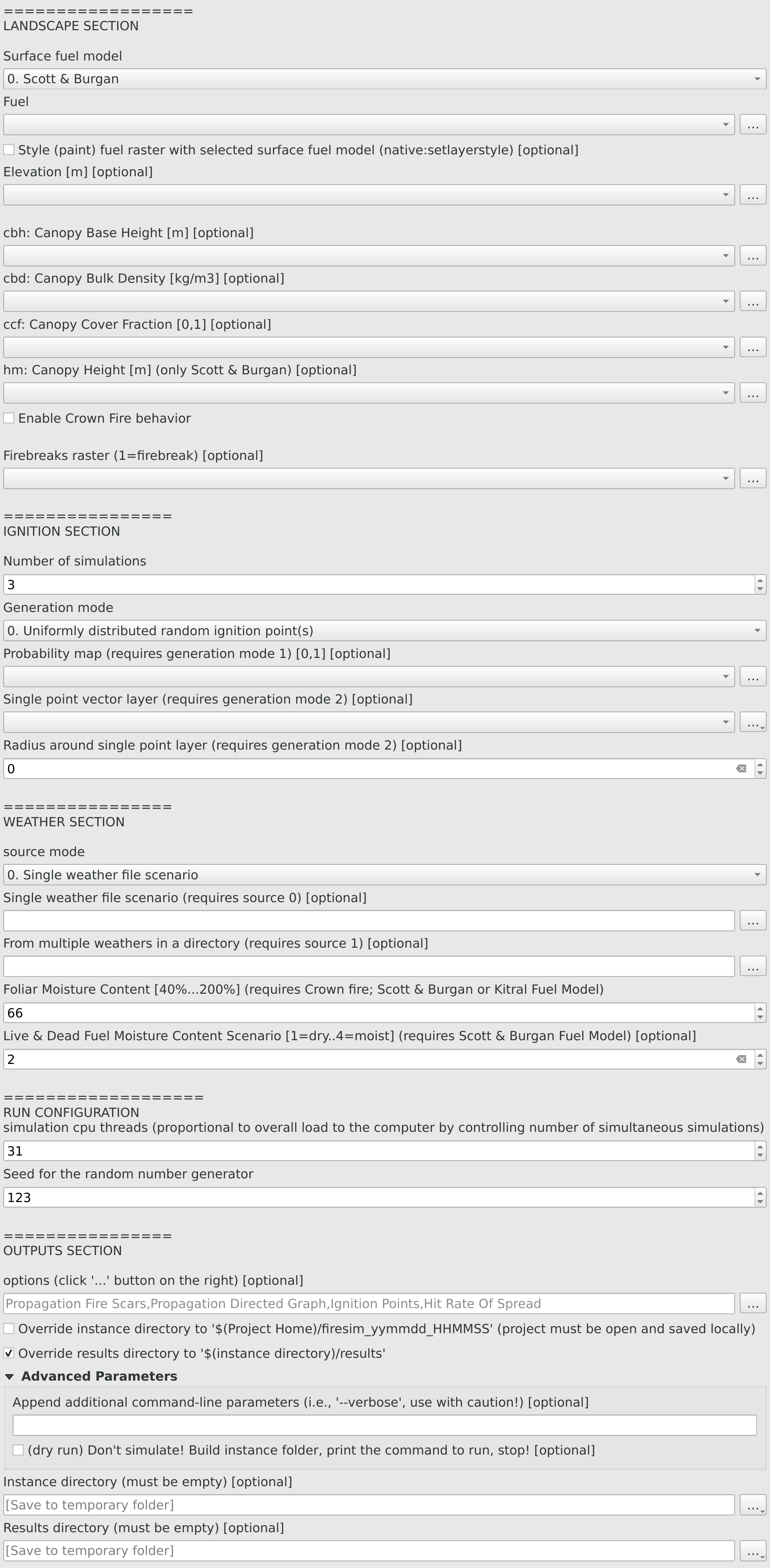
The simulator dialog is divided in four main sections: Landscape, ignitions, weather and outputs. And two optional: run-configuration and advanced options. Altough intuitive (e.g. match each dimensional unit shown in square brackets), each section is commented below:
Landscape
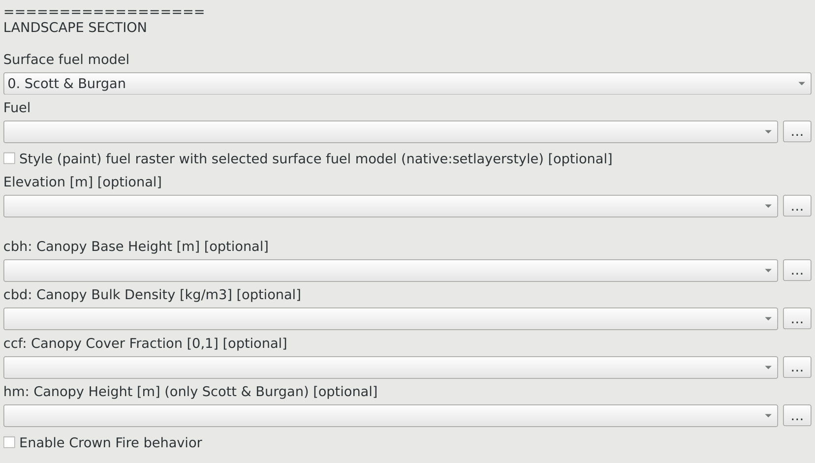
- The surface fuel model must match the fuel raster codification (see lookup tables)
- The style fuel raster checkbox not only “paints” using ‘native:setlayerstyle’ algorithm according to each qml layer style, but also show the classification on the Layers panel
- Enabling crown fire behavior makes sense even without canopy rasters because there are fixed standard numbers for them according to the fuel codification (Only available in Canada’s fuel model)
Ignitions
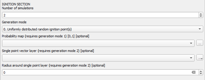
- When simulating one or few simulations, a detailed output is relevant (like propagation digraph and propagation scars)
- When simulating hundreds or thousands, mean and std.dev. statistics are more important than detailed output that can choke the computer unnecessarily (use final scar instead of propagation scars; propagation digraph is input for DPV and Centrality measures; but it can’t be loaded into view!)
- There are 3 ways to generate ignitions:
0. Draw a uniformly distributed random but burnable pixel
1. Draw using a probability map raster
2. Specify a point and optionally a radius to specify a circle from where uniformly draw - If passing various points in the “single point layer”, only the last[?] will be taken into consideration (see feature id (fid) in layer attribute table)
- Note that afterwards there’s a random seed input, hence same seed implies drawing the same point(s sequence)
Weather
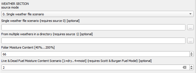
- The simulator assumes constant weather parameters across the grid, they can change over time, but not space
- These parameters are passed into the simulator using a
.csvfile - In a regular simulation each row lasts 1 hour, when the rows end, the simulation ends
- There are two options:
0. Using just oneWeather.csv
1. Drawing at random from a directoryWeathers/WeatherN.csv : N = 1,2,...correlatively named - WIP: A weather database; meanwhile weathers can be obtained from weather.org from any location from 1970 until present day
back to weather spec. | top
Run Configuration
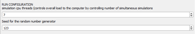
- Only lower the simulation cpu threads if you plan to keep working on something else while the simulations run in the background (for office or web-browsing you’ll never need more than 2)
- Keeping track of the seed yields reproducibility for all generated random numbers
Outputs
This section has three main parts: options, advanced and destination directories. 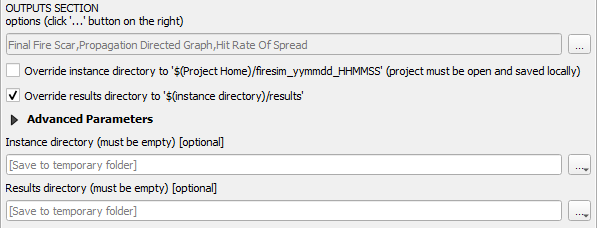
Options
- Access the multiple selection by clicking the
...on the right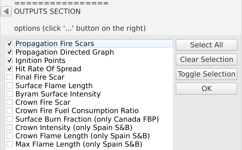
- Most outputs adapt according to being 1 or >1 simulations
- When simulating one or few simulations, a detailed output is relevant (like propagation digraph and propagation scars)
- When simulating hundreds or thousands, mean and std.dev. statistics are more important than detailed output that can choke the computer unnecessarily (use final scar instead of propagation scars; propagation digraph is input for DPV and Centrality measures; but it can’t be loaded into view!)
| output name | unit-type | description |
|---|---|---|
| Propagation Fire Scars | polygons | animate adding the column =now()+ make_interval(hours:=time) |
| Propagation Directed Graph | vector lines periods | edges labeled with simulation event time min |
| Ignition Points | points | pixel id |
| Hit Rate Of Spread | raster float32 m/min | multiband x simulation and bi-band mean&std |
| Final Fire Scars | raster 0,1 | |
| Surface Flame Length | raster float32 m | multiband x simulation and bi-band mean&std |
| Byram Fireline Intensity | raster float32 kW/m | multiband x simulation and bi-band mean&std |
| Crown Fire Scar | raster 0,1 | multiband x simulation and bi-band mean&std |
| Crown Fire Fuel Consumption Ratio raster | 0,1 | multiband x simulation and bi-band mean&std |
| Surface Burn Fraction | 0,1 | multiband x simulation and bi-band mean&std (only Canada FBP) |
| Crown Intensity | raster kW/m | multiband x simulation and bi-band mean&std (only Spain S&B) |
| Crown Flame Length | raster m | multiband x simulation and bi-band mean&std (only Spain S&B) |
| Max Flame Length | raster m | multiband x simulation and bi-band mean&std (only Spain S&B) |
Advanced options
-
Un/Fold the block using the triangle
at the left of Advanced Parameters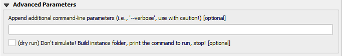
- Any
thingcommand line parameters can be appended, refer to: Technical documentation, the code Cell2Fire.ReadArgs.cpp or this pull request for documentation - Dry run prepares the instance and the command line leaving the execution up to the user. Is a way to gain resources (close QGIS, open a terminal), verify or modify the instance before running
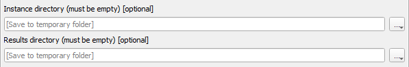
Destination directories:
- The (Cell2)Fire Simulator defines input & outputs (instance & results) directories, reducing complexity by always naming files the same; Fire2a-toolbox takes care of builds these directories and writing files with the proper names [and formats… coming soon].
- tmp means no worries: By default QGIS processing algorithms are ran in memory and/or written to temporary directories; upside always start from a clean slate and OS assited cleaning up, avoid cloud drives messing up; but the downside is being a bit cumbersome to reach those temporary locations. The “Save All” plugin automatically encodes and save all currently loaded layers wherever you choose, use it after loading the results, and never worry about specifying directories.
- There are 3 -mutually exclusive- strategies specifying where to build instance & results directories:
- Temporary
- Don’t fill anything, recommended! (default empty)
- Manually
- specify them: by absolute path o relative to user’s home[?]
- Instance along project
- A directory named
firesim_YYMMDD_HHMMSSwill be created; the project must be saved [in a location without spaces in its path]
- Results inside Instance
- A directory named
resultswill be created inside Instance (default)
Full Dialog